|
||||
| Also available as an Acrobat File | 

|
|
Results |
The Application of Digital Photogrammetric Techniques and Aerial Photography to
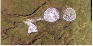
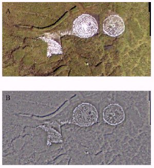
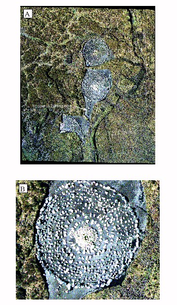
the Preservation of Archaeological Detail. 4 Results and products4.1 1:10000 scale imageryThe 1:10000 imagery produced the orthophoto shown in Figure 3A. Clearly, although this image is a dramatic improvement on the original, it is less than satisfactory from a measurement point of view. The stones are discernible but it is difficult to distinguish individual stones below a certain size threshold. This can be improved somewhat by filtering the orthophoto as shown in Figures 4A and 4B.
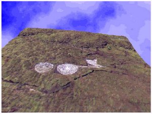
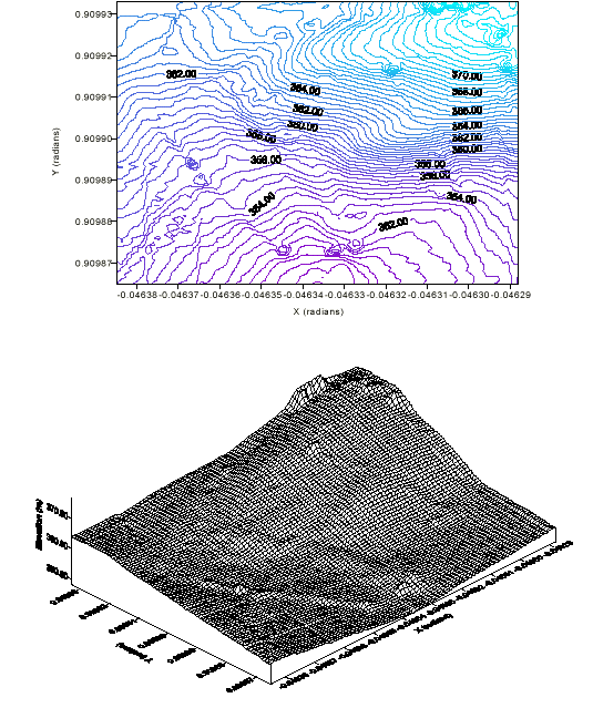
Whilst absolute resolution of the stones was not achievable, the DTM generated facilitates an accurate contour map of the site and it's surrounding environment. This base map is very useful in further site examination and correlation between the position of these stone circles and others still to be excavated. It must be remembered that this image is very accurately constrained, with a ground accuracy of c. 17cm. This may be used to generate a very accurate contour, with contour intervals of as little as 50cm. Thus, even with this relatively low-resolution imagery, it is possible to generate a significant record of the Copney site. Although the ground resolution at a scale of 1:10000 precludes the accurate measurement of the stones themselves, there are still valuable data generated from this survey. Primarily, the accurate generation of the DTM and subsequent processing of the image allows the generation of the orthophoto. This is available as a very accurate base map for future work in the area. Furthermore, the orthophoto represents, in an easily accessible form, the most effective way of storing detailed information on the Copney site. Simply passing the cursor over the stones in the DPW allows the user to immediately get accurate positioning details (as geographic latitude/ longitude or in the grid system of their choosing) and altitude details for any point of the site. It is also possible to generate a Perspective Scene from this scale of imagery. Whilst the stones themselves are not particularly prominent as features, the image can still be used to generate a visually impressive image of the site and can be incorporated into web-based flythoroughs. A Perspective Scene from the 1:10000 DTM is illustrated in Figure 5.
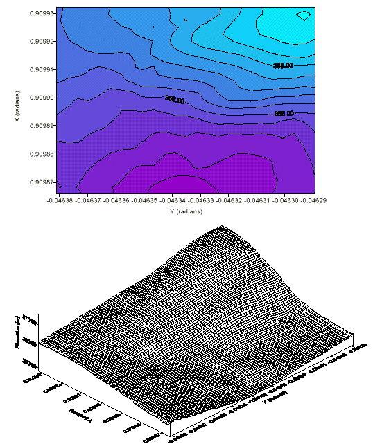
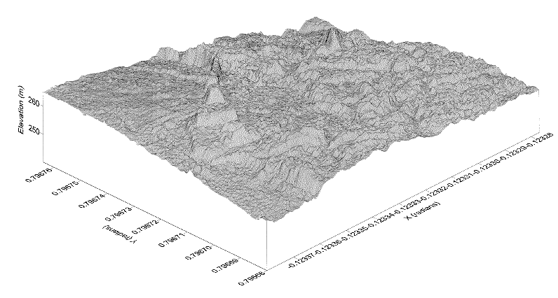
4.2 1:2000 scale imageryThe much better resolution at this scale facilitates the more accurate representation of the Copney site. Digital terrain models were constructed at a range of post spacings from the imagery when orientation and rectification were completed. There is no significant difference in the processing techniques for the different scales of imagery. The DTM's generated from the 1:2000 scale imagery are detailed in Table 1 and Figures 6A to 6C. Larger scale (15m post spacing) DTM's are rapidly generated and form the basis of accurate base maps. These are effectively identical to the base contour maps that could be generated from the 1:10000 scale imagery, as the post spacings are comparable. Finer scale DTM's allow better resolution of the circles, and ultimately the stones themselves. For the purposes of illustration, a 1m spacing DTM is detailed in Figure 6C. This DTM is constructed on an area within Circle B to illustrate the significant resolution of the stones themselves at this scale. This and finer scale DTM's form the basis of the final record of the site.
| |||||
| DTM | X (radians) | Y (radians) | X grid interval (radians) | Y grid interval (radians) | Grid | |
|---|---|---|---|---|---|---|
| 15 m | 0.046385 | 0.909864 | 3.823352 x 10⁻⁶ | 2.352832 x 10⁻⁶ | 26 x 30 = 780 points | |
| 5 m | 0.046385 | 0.909864 | 1.274451 x 10⁻⁶ | 7.842774 x 10⁻⁷ | 77 x 89 = 6853 points | |
| 1 m | -0.123380 | 0.796680 | 2.238874 x 10⁻⁷ | 1.570326 x 10⁻⁷ | 461 x 541 = 249401 points | |
|
Table 1. Specifications of the digital terrain models constructed on the Copney 1:2000 scale images.
The digital terrain maps and orthophotos provide accurate base maps and 3D models against which later surveys can be compared. These images, stored in standard file formats within the DPW can be rapidly recalled for regeneration of images, comparison with newer surveys on the area, generation of specific Perspective Scenes and lines of sight images, addition of man-made features for visual examination of their effect etc. The DTM's are a very effective method of storage of a significant amount of data relating to the Copney site. All of the spatial data relating to the site and the individual stones is rapidly accessible and can be output in a graphically impressive form for illustration of features to specialists and non-specialists alike. Furthermore, the powerful data and image export facilities of the system allow export to most major imaging packages and GIS software for more specialized spatial and statistical analysis. Perhaps the most significant value of such a compact and accessible data storage method is that the accuracies and reliability of data can be readily calculated for implementation into modeling programs and statistical analysis. |
||||||
Graphics Multimedia Virtual Environments Visualisation Contents