|
||||
| Also available as an Acrobat File | 

|
|
Future Developments |
Visual Communication in Urban Planning and Urban Design5 Future Developments5.1 Towards the Virtual CityAs can be seen from the previous sections, there are numerous ways of visualising digital environments which can facilitate planning, and the simulation of processes which affect the urban environment. These digital environments can obviously vary in terms of the way in which they are constructed and presented. Furthermore, the underlying real world information can be tailored to serve a variety of tasks within the planning and urban design. The uptake of digital technologies in this context range from the visualisation of change to collaborative online planning and so on, thus pushing us towards the creation of virtual cities or towns. Virtual cities is a term which has been used to describe a diverse range of information interfaces, that are particularly prevalent on the World Wide Web (WWW). To date there are four main online environments which have had the label attached to them;
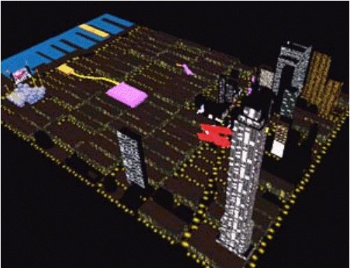
The third and fourth types of virtual city are the ones which planners and urban designers can utilise in decision making processes. By modelling aspects of the built environment in VRML or by using photospatial panoramas, vivid models can be created which can be applied to a variety of planning and design scenarios. By creating 3D Virtual Cities, such as Virtual New York (Figure 28) where real world objects and entities are modelled to a given level of accuracy, a reasonable visual forum can be created for professional decision making purposes.
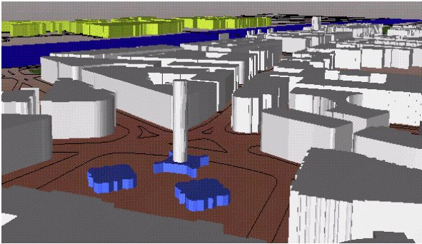
By digitally modelling the physical world in 3D we begin to create facsimiles of our own environment. The level of realism required or achieved obviously depends upon the end purpose and also on technical and institutional considerations. Nonetheless the creation of what we have described as true virtual cities is possible. There is a wealth of spatial digital data available to planners and urban designers, brought to the desktop via the growth in use of GIS and CAD packages. Data providers such as Ordnance Survey and Experian (Goad) hold accurate digital geometric information down to the building polygon level. By exploiting this kind of footprint information we can begin to construct the foundations of our true virtual cities. Creating such models from quality assured datasets, we can really begin to bring the physical world onto the desktop. Whilst problems do exist in that buildings are usually complex structures and are not merely extrusions of their footprints, the facility to produce generalised representations exists. This is perhaps more applicable to wider or strategic scale applications at the urban rather than the building scale. This leads to the question, how real do virtual reality or virtual models have to be? Figure 29 shows a section of a model of Westminster which has been created by the authors. In it Nelson's Column is visible and identifiable by context. At an urban scale we probably need to do little to represent this element of the built environment. At the building scale, however, it may be important to add more detail or textures to the Trafalgar Square area. It may be the case that a new kind of paving is to be put in place, at this scale textures and rendering become more important.
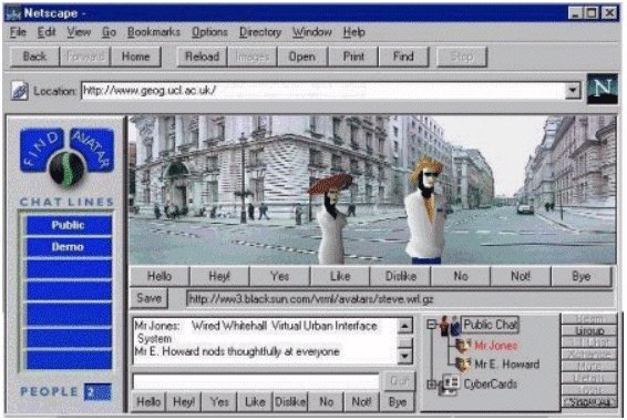
Beyond this convergence of GIS and VRML or solid modelling, we can also embrace techniques which are currently browser oriented in order to solve planning and design problems. By taking our digital geographical data and placing it within a multi-user world we can, again, help planners plan and designers design. If an accurate, realistic context can be set, the design/planning process can become more digital and also more democratic in terms of its ability to be distributed in digital form (over the WWW or via a Planning Department's Intranet). With the web browser facilitates we have been discussing with GIS, VRML, multi-user worlds enabled, we are able to interact with objects and information in a more completely than if the applications were in isolation. This holistic approach may result in an object-oriented database being created within a given urban environment, which populates the virtual space with both structures (plus or minus building textures) and attribute information. Avatars can then be introduced, as in the Virtual Design Arenas (Section 2.5). Information could be obtained by `touching' building polygons or by crossing into various land parcels where the data is served through a web hotlink or from an underlying data store. Whilst true virtual cities are really still in an embryonic stage, the ability to simulate urban interaction within a VR context is now in place. As in a real place, social interaction can occur as can planning and design changes to physical layouts in real time. Laws can also be applied and enforced in terms of personal and professional behaviour and permissible actions.
|
Graphics Multimedia Virtual Environments Visualisation Contents