|
Editorial
Abstract
Introduction
Geometric models
Photorealistic media
Development
Communication
Augmented reality
Visual Communication
Future Developments
References
WWW Resources
Virtual Environments
Case Studies Index
|
Visual Communication in Urban Planning and Urban Design
3.2 Photorealistic Visual Communication
3.2.1 Virtual StreetScape
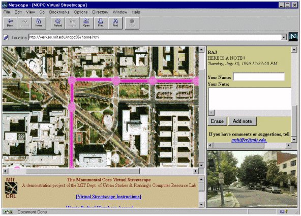
Figure 21 illustrates "The Virtual Streetscape" an example of the
use of QTVR to visualise the built environment. Developed as a demonstration
project of the MIT Department of Urban Studies & Planning's Computer
Resource Laboratory, the Virtual Streetscape illustrates how 360 degree
panoramic views can be linked to aerial photographs to create a linkage between
more traditional, two dimensional images and three dimensional VR scenes.
Figure 21. "Virtual Streetscape" (Computer Resource Lab, Dept.
of Urban Studies & Planning, MIT)
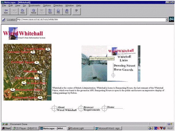
3.2.2 Wired Whitehall Virtual Urban Interface System
Wired Whitehall integrates information relating to the built environment
through photospatial scenes using hot linking software by Jutvision
(http://www.visdyn.com), and as shown in Figure 22, is similar in
concept to the Virtual Streetscape.
Wired Whitehall is being developed to integrate real world planning data behind
its visual interface into a Virtual Urban Information System. The user will be
able to `click' on a building within the photorealistic scene and obtain
detailed planning documents.
While the use of photo-realistic VR scenes on the WWW provides a visual way to
communicate planning information its use is limited. To be able truly to
communicate planning and urban information, the end user should be able to
interact with objects within the same environment.
To allow this, representations of real world objects can be placed within the
panoramas. This object placement augments the actual with the
proposed thus allowing an end-user to simulate or visualise proposed
change in a specific location. This technique is encompassed within the broad
term of Augmented Reality (AR) (Tuceryan et al 1995).
Figure 22. Wired Whitehall Virtual Urban Interface System
|