|
||||
| Also available as an Acrobat File | 

|
|
|
Visualisation in the Social Sciences WorkshopShow and TellJames Macgill | |
|
The research was part of a project that looked into the role GIS and the
WWW will play in improving public participation in local environment
decision making.
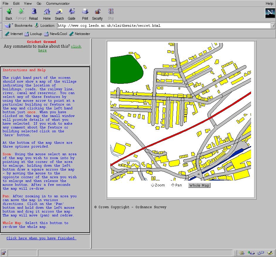
The first investigation produced an interactive on-line map of the village of Slaithwaite as part of the 'Planning for Real' initiative. Issues addressed included -
By providing an interactive map that can be placed on web pages and by providing an interface that allows members of the public to submit comments about any part of their village. It has been tested both on-line and by taking a network of computers to Slaithwaite sports center where the system was actively used by over 300 members of the community.
Tools used:In addition to html and cgi for form and web page design, the Slaithwaite project was put together using a Java class library known as GeoTools, which was developed here at Leeds. It provides a way to read and display vector (and now raster) maps and allows for typical shading, scaling, paning and querying operations. All of this is done in an applet on the clients web browser without any server side support. If you require any further details then please contact me.Contact DetailsJames MacgillEmail: pgjm@geography.leeds.ac.uk Centre for Computational Geography School of Geography Leeds University |
||
Graphics Multimedia Virtual Environments Visualisation Contents