|
||||
| Also available as an Acrobat File | 

|
|
Site Details |
The Application of Digital Photogrammetric Techniques and Aerial Photography to
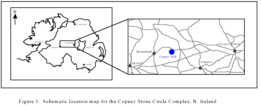
the Preservation of Archaeological Detail. 2 Site details and aims of the studyNorthern Ireland has a wealth of archaeological sites, which reflect human activity in the region from the earliest Neolithic. The earliest sites comprise individual standing stones and stone circles, and some of the most important and complex of these have been excavated from beneath peat bog. The Copney Stone Circle Complex (CSC), County Tyrone, N. Ireland (H599782, Figure 1) is an important Bronze age site forming part of the Mid-Ulster Stone Circle Complex. The complex is situated on the northern slope of Copney Hill and runs down-slope along a NW-SE axis. The CSC was first noted in 1979 and surveyed in 1981. It became a scheduled monument in March 1993 and was taken into State Care Guardianship in 1990, at which point the site, located in peat bogs, was still un-excavated. The Environment Service: Historic Monuments and Buildings (ESHMB) initiated a program of bog-clearance in August 1994. This work was completed by October 1994 and the excavated site was surveyed in August 1995. Only two of the circles (of a total of nine) and a quarter of a third were excavated at this time. The present visible site comprises these circles (designated circles A, B and C, a stone alignment between circles B and C and a standing stone (Plate 1).
The complexity of the CSC makes it unique amongst the Mid-Ulster stone circles. As a result, the accurate recording of the details of the site and its components is essential. This requirement became even more important in light of the survey reports following the initial site survey report (MacDonagh, 1995). In this report, the surveyors remarked upon the condition of the stones making up the Complex, particularly their apparently high rate of decay since excavation. The decay of such a site represents a significant loss to both the archaeological record and to the public. For this reason, excavation of the site was paused to allow examination of the stones, surveying and the construction of conservation pathways for the site. The surveyors therefore recommended monitoring of specified keystones within the complex to estimate decay whilst decisions regarding conservation were considered by EHSMB. At this point, a program of study was initiated in the School of Geosciences, The Queen's University of Belfast to investigate decay features and the effect burial in peat has on the structure and mineralogy of the stones as a means of informing management decisions for this site. The report generated from the first phase of this study (Curran et al, 1997) highlighted the following problems:
As a result of this preliminary study, a number of remedial actions were suggested to the EHSMB ranging from preservation of the stones using chemical treatment and/or cover to reburial of the site after site preparation to preserve the stones. In choosing how to best preserve the information in the CSC, the EHSMB require an accurate determination of the projected decay rate of the site as a whole and of individual features within the site. Furthermore, development of the site including construction of access routes such as elevated walkways, and covering the site from prevailing winds has been suggested. Thus a rapid method of visualizing the effects of development on the site both from a structural and aesthetic point of view would be beneficial. More importantly, a permanent record of site details through time facilitates examination of changes to the site. The aims of this study were therefore to evaluate the use of aerial photographic and photogrammetric techniques to the characterization of the Copney Stone Circle Complex and specifically to provide:
To highlight the usefulness of this technique in both detailed and more landform-based applications, two sets of images were treated:
2.1 Photogrammetry and the Leica-Helava Digital Photogrammetric WorkstationThe Helava Digital Photogrammetric Workstation (DPW) represents a powerful tool in the analysis and generation of data from digitally scanned images. The DPW is equipped with two high resolution monitors and a stereo video card. One monitor is used for viewing the software package and the other (extraction monitor) is used to see the imported images as they are overlapped. Using a pair of stereo glasses, the overlap area may be observed in 3D and features examined for analysis. Furthermore, this capability of the system allows the accurate placement of ground control points onto the surface rather than floating above the image. The Copney Stone Circle Complex, like many similar sites in Northern Ireland, is surrounded by waterlogged peat bog which makes human access difficult and vehicular access impossible. Therefore, it is not possible to acquire initial photography of the site by conventional means (using scaffolding or crane) but necessitates the use of aerial photographs. The DPW was applied to the calibration and rectification of aerial photographs acquired of the CSC. Aerial photography facilitates the capture of the entire site in a single image (and a considerable amount of the surrounding terrain). Processing of this image allows the rapid and precise recording of data from this complex site and enables the creation of a baseline against which the success or failure of conservation treatments may be compared. Additionally, it allows the graphical presentation of information in formats that are easily examined and presented to researchers and the public. |
Graphics Multimedia Virtual Environments Visualisation Contents